


Nationa Data Repository (NDR)

Open Data
Log of announced changes
September
Further data warehouse enhancements to the NSTA's data has resulted in the following attribute has been added to the wells service:
The licence number at total depth (TD).
| Attribute | Alias |
|---|---|
| TDLICNO | Licence No. at Total Depth (TD) |
The alias for licence number has also been changed.
| Previous | New |
|---|---|
| Licence No. | Licence No. at Well Origin |
August
As part of the gradual enhancements to the NSTA data warehouse system the following attribute has been added to the wells service:
The organisation group name for the operator responsible for the wellbore.
| Attribute | Alias |
|---|---|
| RESOPGRP | Responsible Operator Group Name |
March
On the 21st of March 2022, the Oil and Gas Authority changed its name to the North Sea Transition Authority. As a result, the GIS web services were altered to reflect the name change.
The previous ogauthority services to our data are to be turned off on the 15th April 2022.
Anyone who used the ogauthority API’s can use this look up table to find the updated services.
December
On the 13th of December we released new schemas and services for infrastructure data.
The previous infrastructure data included surface, subsea, pipelines and freespan locations.
It has now been expanded upon and restructured to include the below categories:
- Pipeline Points
- Pipeline Linear
- Pipeline Freespans
- Subsea Points
- Subsea Linear
- Surface Points
June
On 30th June, we added two new attributes to the licences service.
| Attribute | Alias |
|---|---|
| CUR_PHASE | Current Phase |
| CUR_TERM | Current Term |
On 24th June, we added new attributes to the wells service.
| Attribute | Alias |
|---|---|
| TDOPERATOR | Subarea Operator at TD |
| TDSAOPNUM | Subarea Operator at TD Number |
| TDOPPREV | Subarea Operator at TD |
| TDOPPREV | Subarea Operator at TD Previous Names |
| TDOPGRP | Subarea Operator at TD Group Name |
| ENTITYTYPE | ENTITYTYPE Data Reporting Entity Type |
| REPENTREAS | Reason for Reporting Entity |
| DATAREPENT | Well Data Reporting Entity |
| DATAENTNUM | Data Reporting Entity Number |
| DATAENPREV | Data Reporting Entity Previous Names |
| DATAENGRP | Data Reporting Entity Group Name |
| COMPOPNUM | Competent Operator Number |
| RESPOPNUM | Responsible Operator Number |
May
On 26th May, we have added two attributes to the PPRS service.
| Attribute | Alias |
|---|---|
| GASINJCV | Gas Injected - CV (MJ/sm3) |
| GASINJVOL | Gas Injected - Volume (Ksm3) |
And two attributes were removed from the PPRS service. This is because the values were originally reported as volume (m3) rather than mass (kg) and inferring that volume equals mass may not always be accurate.
| Attribute | Alias |
|---|---|
| INJWATMASS | Injected Water - Mass (Kg) |
| WATPRODMAS | Produced Water - Mass (Kg) |
On the 3rd May, we made a schema change and supplemented the Licences service. For more information, please see here to see full details of the new schema.
March
On the 25th March, we have added two new attributes to the Wells services.
| Attribute | Alias |
|---|---|
| SUBOPNO | Subarea Operator Number |
| SUBOPGRP | Subarea Operator Group Name |
January
On the 9th January, we changed the Onshore Wells service, and have now updated its schema, and have included Well Bottom hole locations and Top-Bottom straight-line connection. All data is now being sourced from WONS. For more information, please see here.
We have introduced new attributes into the Offshore Wells services.
| Attribute | Alias |
|---|---|
| MAPSYMDESC | Map Symbol Description |
| MULTILAT | Is this Wellbore Multilateral? |
| LANDRIG | Land Rig Name |
| NORIGREAS | Explanation for No Rig |
| FIXMOBILE | Drilling Unit Type |
| PANOTICEDT | Plugged and Abandoned Notice Date |
January
On the 29th January, we made changes to the Licence and Licence Block History datasets.
- We have now included the registered company numbers with the licencee, administrator or operator values.
- In the “Licence Block History_[CRS]” dataset, we have included historical changes in company names. Three new attributes have been created:
- ADMHISNAME - historical admin organisation name
- LICHISNAME - historical licensee organisation names
- OPHISNAMES - historical operator organisation names
October
On the 1st October, the “FIELDDATA” attribute from our “Offshore_Fields_[CRS]” datasets were removed. This was recognised as a redundant legacy attribute.
August
On 8th August, two new fields were added to the “Licences_[CRS]” datasets to help identify Licence documents. These are
URL – This is a web link to the Licence document
PDFDATEADD – This is the date the link was added to the dataset.
June
On 5th June, we changed a field name in 4 of our web mapping services with the “Licensed and Unlicensed Blocks_[CRS]” layer. For details on schema changes, please see here.
May
On 17th May we added some attributes to the spatial hydrocarbon fields datasets. This was the first in a series of intended improvements for attribution of field header data.
Some fields will, from now on, be up to date regarding partners and equities, others will continue to not be updated regularly until we can roll out further improvements. For details on schema changes and which fields will be updated, please see here.
April
We have changed our address for NSTA services, please replace itportal.nstauthority with data.nstauthority, so for example for REST services:
OLD: https://itportal.nstauthority.co.uk/arcgis/rest/services
NEW: https://itportal.nstauthority.co.uk/arcgis/rest/services
The old address was switched off on 30th April.
January
On 3rd January, we added an attribute to the version of the sub areas service and file downloads called OPFLAG which contains a 'Y' if the equity holder for a given record is the operator for that sub areas.
August
On 6th August, we will rationalise some services. No data will be removed, but certain information will appear in different services. Refer to the table below for details
| Folder | Service to be rationalised | New service |
| NSTA_Public_ED50 | NSTA_Rd29_Blocks Offered_ED50 | NSTA_RoundOfferedBlocks_ED50 |
| NSTA_Public_ED50 | NSTA_Rd30_BlocksOffered_ED50 | NSTA_RoundOfferedBlocks_ED50 |
| NSTA_Public_ED50 | NSTA_Rd31_BlocksOffered_ED50 | NSTA_RoundOfferedBlocks_ED50 |
| NSTA_Public_ED50 | NSTA_Sup2016_Blocks_Offered_ED50 | NSTA_RoundOfferedBlocks_ED50 |
| NSTA_Public_ED50 | NSTA_Sup2016_Awards_ED50 | NSTA_RoundAwards_ED50 |
| NSTA_Public_ETRS89 | NSTA_Rd29_Blocks_Offered_ETRS89 | NSTA_RoundOfferedBlocks_ETRS89 |
| NSTA_Public_ETRS89 | NSTA_Rd30_Blocks_Offered_ETRS89 | NSTA_RoundOfferedBlocks_ETRS89 |
| NSTA_Public_ETRS89 | NSTA_Rd31_Blocks_Offered_ETRS89 | NSTA_RoundOfferedBlocks_ETRS89 |
| NSTA_Public_ETRS89 | NSTA_Sup2016_Blocks_Offered_ETRS89 | NSTA_RoundOfferedBlocks_ETRS89 |
| NSTA_Public_ETRS89 | NSTA_Sup2016_Awards_ETRS89 | NSTA_RoundAwards_ETRS89 |
| NSTA_Public_WGS84 | NSTA_Rd29_Blocks_Offered_WGS84 | NSTA_RoundOfferedBlocks_WGS84 |
| NSTA_Public_WGS84 | NSTA_Rd30_Blocks_Offered_WGS84 | NSTA_RoundOfferedBlocks_WGS84 |
| NSTA_Public_WGS84 | NSTA_Rd31_Blocks_Offered_WGS84 | NSTA_RoundOfferedBlocks_WGS84 |
| NSTA_Public_WGS84 | NSTA_Sup2016_Blocks_Offered_WGS84 | NSTA_RoundOfferedBlocks_WGS84 |
| NSTA_Public_WGS84 | NSTA_Sup2016_Awards_WGS84 | NSTA_RoundAwards_WGS84 |
| NSTA_Public_WGS84 | NSTA_Pre31stRoundAvailableData_WGS84 | NSTA_Data_Initiatives_AOIs_WGS84 |
| NSTA_Public_WGS84 | NSTA_PWA_Wells_WGS84 | NSTA_Data_Initiatives_AOIs_WGS84 |
| NSTA_Public_WGS84 | BGS_21CXRM_Palaeozoic_AOI_WGS84 | NSTA_Data_Initiatives_AOIs_WGS84 |
| NSTA_Public_WGS84 | NSTA_30thRoundAvailableData_WGS84 | NSTA_Data_Initiatives_AOIs_WGS84 |
| NSTA_Public_WGS84 | NSTA_RegionalGeologyMaps_WGS84 | NSTA_Data_Initiatives_AOIs_WGS84 |
July
On 5th July, we will add the attribute DEVIATTYP to well header downloads and services in all three coordinate reference systems.
June
- On 20th June, we will make a reformatted version of sub areas available. This version will have one record per equity group holder. It will be available to download via the Open Data site, and added as an extra layer in the NSTA_Licences_XXX web services in ED50, ETRS89, WGS84 and BNG coordinate systems. The existing sub areas dataset schema will remain unchanged.
- On 4th June, we will expand the NSTA_LicenceRelinquishments services and relinquished block downloads to include all relinquished licences for the UKCS. The service and download for these will continue to have links to the associated relinquishment reports. There are some schema changes associated with this change. See the new sheet ‘relinquishments’ here for more details
April
- On 16th April, we will switch off the GovSeismic services in the WGS84, ETRS89 and ED50 folders.
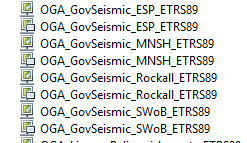
The same data is held in the NSTA_Government_Seismic folder under their respective CRS service. No data will be lost.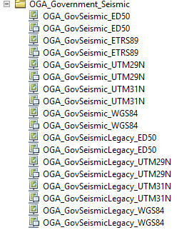
March
- Services domain change. On 27th March, our services will be using itportal.nstauthority.co.uk instead of itportal.decc.gov.uk. This will affect all our web mapping services.
- Well schema changes. See here for more details.
February
- Licence Schema Changes. See here for more details
- The web services: NSTA_Unsanctioned_Discoveries in all three coordinate systems and NSTA_Undeveloped_Discoveries_Montages in all three coordinate systems have been replaced by NSTA_Undeveloped_Discoveries in all three coordinate systems. This was a data rationalisation exercise, no information has been lost.
- The web services for 29th and 30th Round Indicative areas in all three coordinate systems have been replaced by NSTA_RoundIndicativeAreas in all three coordinate systems. The only difference between retired and current services is that we now include multiple indicative areas in one service. Indicative areas dating back to 29th round are included in this service and future indicative areas will be included here too. No information has been lost.