


Onshore licence coordinates are defined using the National Grid referencing system, which is a metric grid on a Transverse Mercator projection.
National Grid coordinates are expressed as distances measured in metres east and north from the grid origin, which is located west of the Isles of Scilly. The National Grid defines a series of 100km squares, each of which is further subdivided into 10km squares. The 100km squares are identified by two letters, e.g. SE or TL. The 10km squares are identified by the letters of the 100km square within which they lie, plus a number from 00 to 99 as follows:
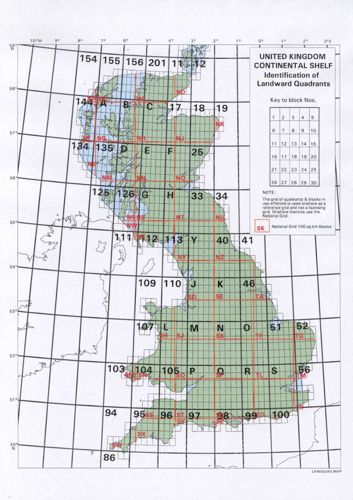
Onshore licence coordinates
| 09 | 19 | 29 | 39 | 49 | 59 | 69 | 79 | 89 | 99 |
| 08 | 18 | 28 | 38 | 48 | 58 | 68 | 78 | 88 | 98 |
| 07 | 17 | 27 | 37 | 47 | 57 | 67 | 77 | 87 | 97 |
| 06 | 16 | 26 | 36 | 46 | 56 | 66 | 76 | 86 | 96 |
| 05 | 15 | 25 | 35 | 45 | 55 | 65 | 75 | 85 | 95 |
| 04 | 14 | 24 | 34 | 44 | 54 | 64 | 74 | 84 | 94 |
| 03 | 13 | 23 | 33 | 43 | 53 | 63 | 73 | 83 | 93 |
| 02 | 12 | 22 | 32 | 42 | 52 | 62 | 72 | 82 | 92 |
| 01 | 11 | 21 | 31 | 41 | 51 | 61 | 71 | 81 | 91 |
| 00 | 10 | 20 | 30 | 40 | 50 | 60 | 70 | 80 | 90 |
Example: If this diagram showed the SE block, then square 46 would be referred to as SE46.
DESNZ refers to each 10km square as a block. A licence may cover a whole block, part of a block, or several blocks or part-blocks.
Map of the UKCS illustrating the relationship between the National Grid and quadrants
Ordnance Survey website offers further information on the National Grid.
The system of quadrants and blocks used in offshore licensing does extend onshore, but we only use it for well numbering (see Petroleum Operations Notice 12 for details).